The White Sage Fire reached 100% containment on September 12, 2025, after burning nearly 59,000 acres on BLM Arizona Strip and North Kaibab Ranger District lands. Together with the Dragon Bravo Fire, the two fires affected nearly 205,500 acres of public lands in northern Arizona.
Coconino County · 2025
White Sage Fire
Historical · 8,641 acres · Final report · contained September 10, 2025
Loading map…
About the White Sage Fire
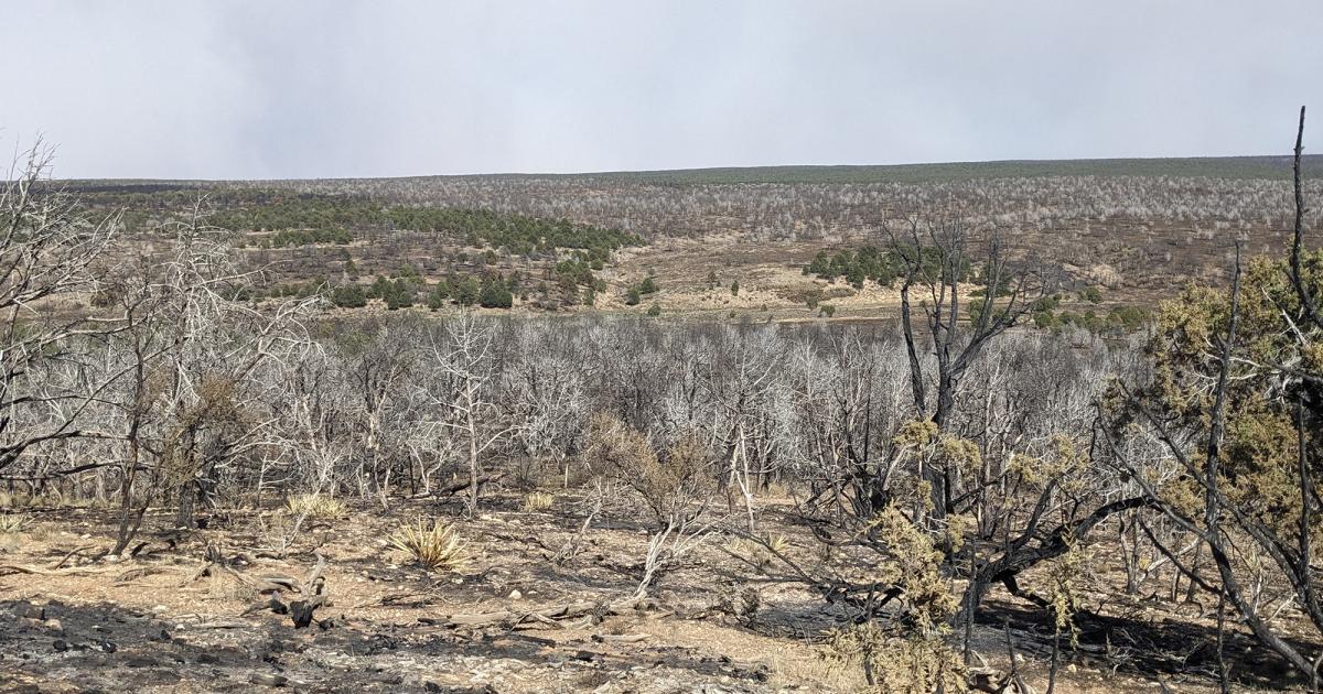
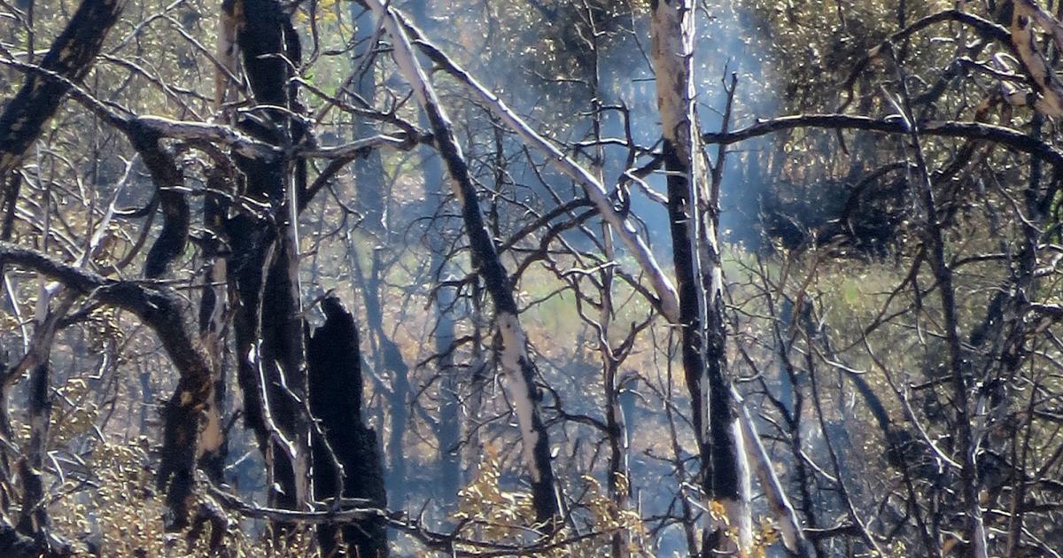
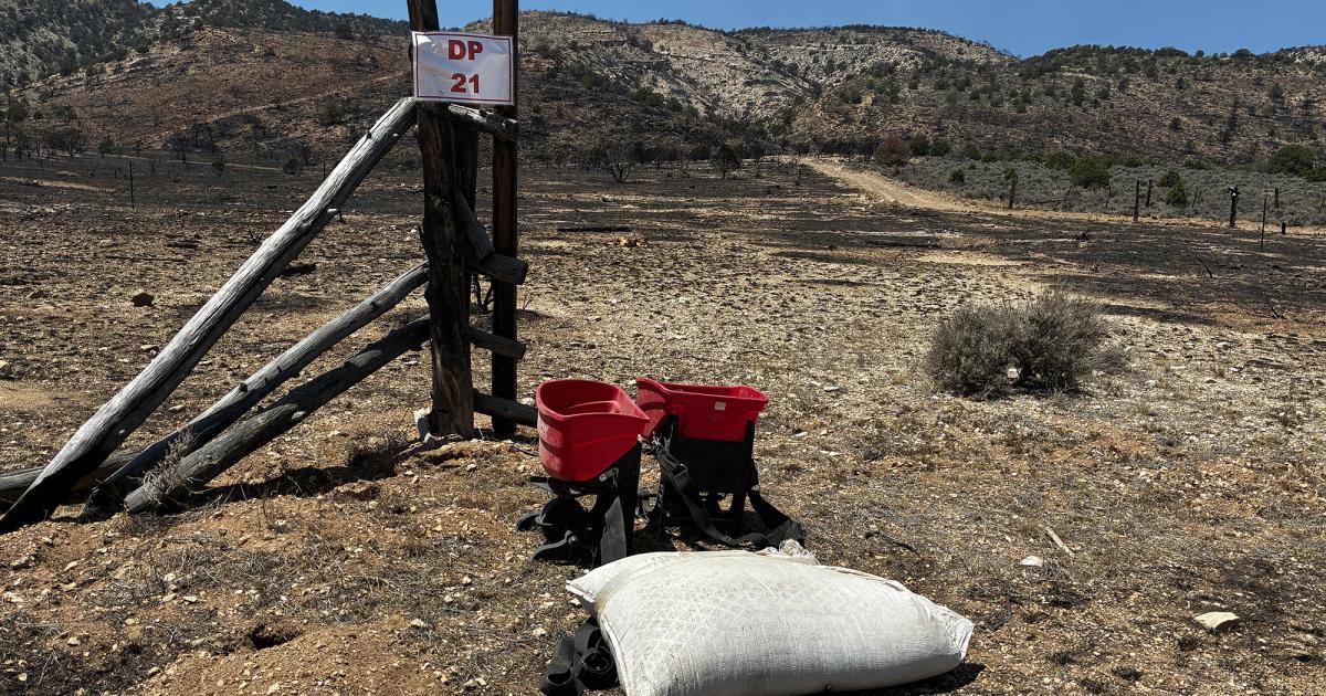
The White Sage Fire was a 58,985-acre lightning-caused wildfire on the Kaibab Plateau in Coconino County, Arizona. It was first reported on July 9, 2025 and reached containment on September 10, 2025.
White Sage burned simultaneously with the much larger Dragon Bravo Fire to the south, on the same Kaibab Plateau forest landscape. Together the two fires shaped the 2025 North Rim summer and triggered closures across Grand Canyon National Park and the surrounding national forest land.
Incident data comes from the NIFC Wildland Fire Interagency Geospatial Services (WFIGS) feed. Final acreage and containment dates reflect the closeout report from the assigned incident management team.
News coverage
These headlines link to reporting by news outlets and agencies, not by AZMap.
- White Sage and Dragon Bravo fires
- Burned Area Emergency Response (BAER) team assessing fire severity on the White Sage Fire
Kaibab National Forest initiated a BAER assessment of the 58,985-acre White Sage Fire burned area on August 1. The interdisciplinary team is surveying for flash flood and debris flow risks and will produce a soil burn severity map to guide emergency stabilization on federal lands.
- White Sage Fire reaches 95% containment; local units assume command
The White Sage Fire reached 95% containment at 58,985 acres as of August 2, when local North Kaibab and BLM Arizona Strip units took over command from Color Country Team 2. A Burned Area Emergency Response team began evaluating fire impacts to determine rehabilitation needs.
- White Sage Fire reaches 95% containment; BAER team begins post-fire assessment
The White Sage Fire is 95% contained at 58,985 acres as of August 1. A BAER team has begun evaluating fire impacts for rehabilitation, suppression line repair is ongoing, and U.S. Route 89A and House Rock Valley Road are open.
- White Sage Fire at 83% containment; Highway 89A reopens as suppression repair continues
The White Sage Fire is at 83% containment and 58,985 acres as of July 31. U.S. Route 89A has reopened and crews are spreading native seed and repairing suppression lines across the fire footprint; smoldering within the perimeter is expected to continue for weeks.
- White Sage Fire: Highway 89A reopens as BLM rescinds Vermilion Cliffs closure
The White Sage Fire reached 83% containment at 59,070 acres on July 28. BLM rescinded the fire area closure near Vermilion Cliffs National Monument and reopened Highway 89A, while suppression repair crews spread native seed and rebuilt fences across the fire footprint.
- BLM rescinds Vermilion Cliffs closure as White Sage Fire holds at 83% containment
The White Sage Fire is at 83% containment across 59,065 acres as of July 27. BLM Arizona Strip District lifted the fire area closure near Vermilion Cliffs National Monument, reopening FR 22 and House Rock Valley Road, while crews continue suppression repair and reseeding.
- White Sage Fire Daily Update - July 16, 2025
A lightning-started fire ignited July 9 near Fredonia spread onto the North Kaibab Ranger District, reaching 52,990 acres at 4% containment by July 16. Extreme fire behavior including crown runs and spotting was ongoing, with 667 personnel assigned and Coconino County evacuation notices in place.
- White Sage and Dragon Bravo fires: The latest on the wildfires in northern Arizona
KJZZ's live updates page tracks the White Sage and Dragon Bravo fires across northern Arizona from ignition in July through containment in September 2025. Coverage spans acreage growth, road closures, evacuation orders, and crew operations near the Grand Canyon's North Rim.