
KTAR reported the Rock Canyon Fire reached 75% containment on June 23 at 4,823 acres, up from 50% the day before. Officials said they would stop issuing updates barring unforeseen changes and began reassigning resources to other regional fires.
Coconino County · 2026
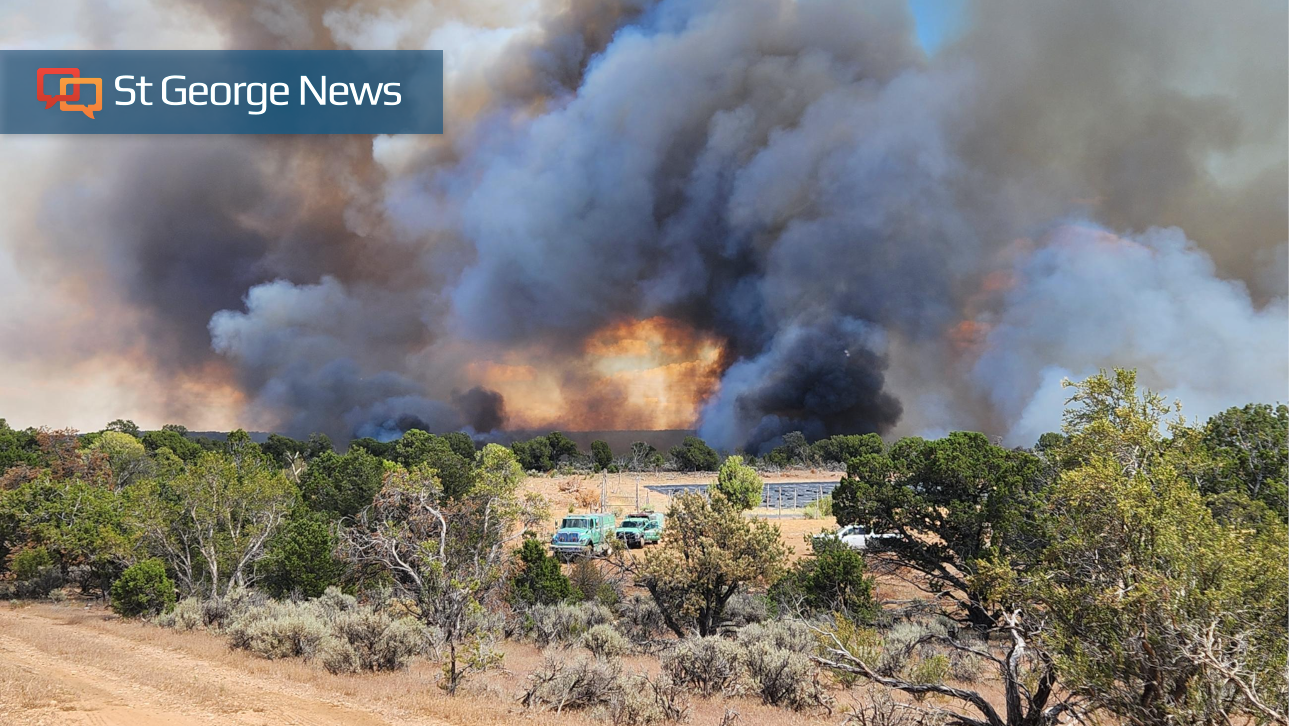
Rock Canyon
Active · 4,823 acres · 98% contained
- Acres
- 4,823
- Containment
- 98%
- Last update
- —
Source: NIFC WFIGS feed
Current status
As of June 25, 2026, NIFC reported the Rock Canyon Fire at 4,823 acres and 98% contained, with fire activity minimal across the incident. The Arizona Southeast Zone team's June 23 update, which managers said would likely be the last, described crews extinguishing isolated heat sources and beginning suppression repair, including dozer-line repair and seeding to stabilize soil.
Area closures on Bureau of Land Management and Kaibab National Forest land remained in place while repair work continued.
Sources: NIFC, InciWeb, Bureau of Land Management, Kaibab National Forest
Recent updates
These headlines link to reporting by news outlets and agencies, not by AZMap.
- Firefighters close in on full containment of Rock Canyon Fire in northern Arizona
- Strengthened containment lines on Rock Canyon Fire
As of June 22, the Rock Canyon Fire covers 4,823 acres and is 50% contained, with 274 personnel on scene. Crews have begun suppression repair on contained sections, including rehabilitating dozer lines and stabilizing soil to prevent erosion.
- Arizona wildfires burn thousands of acres as Nevada smoke reaches Kanab
The Rock Canyon Fire reached 4,823 acres and 30% containment as of June 21, with closures in effect on Kaibab National Forest lands and along State Route 89A. Weekend smoke visible in the Kanab area came from fires in eastern Nevada, not from the Rock Canyon Fire.
- North Kaibab Ranger District Stage 2 Fire Restrictions effective June 18
The Kaibab National Forest placed the North Kaibab Ranger District under Stage 2 fire restrictions on June 18 as the Rock Canyon Fire burned. The order bans campfires, smoking outside enclosed areas, and most equipment use from 9 a.m. to 8 p.m.
- Rock Canyon Fire grows near the Utah-Arizona state line
Strong winds pushed the lightning-caused Rock Canyon Fire east toward House Rock Valley, growing it past 2,200 acres at 5% contained as of June 17. The fire spread partly through the White Sage Fire burn scar, where regrown cheat grass carried flames faster than crews expected.
- Kaibab National Forest | Rock Canyon Fire Information
The Rock Canyon Fire, detected June 15, 2026 on the BLM's Arizona Strip District, is burning across BLM and Kaibab National Forest lands with Stage 2 fire restrictions in effect on the North Kaibab Ranger District. A Color Country Type 3 Incident Management Team is in command.
- Rock Canyon Fire in northern Arizona now 3K acres, campgrounds threatened
Arizona's Family reported the Rock Canyon Fire had grown to about 3,000 acres by June 17, threatening campgrounds near the Utah-Arizona line as crews worked to slow its eastward push.
- Rock Canyon Fire reaches 500 acres east of Fredonia; Dellenbaugh Fire up to 400 acres
The Arizona Daily Sun reported the lightning-caused Rock Canyon Fire had reached 500 acres east of Fredonia by mid-June, one of two new Arizona Strip fires alongside the Dellenbaugh Fire near Kingman.

Loading map…
About the Rock Canyon
Rock Canyon is an active wildfire in Coconino County, Arizona. First reported June 15, 2026. As of the latest NIFC update the fire had burned 4,823 acres at 98% containment. Cause: Natural.
Live incident data comes from the NIFC Wildland Fire Interagency Geospatial Services (WFIGS) feed.