
Cibola farmers lost their main equipment route when the fire took out the Hart Mine Bridge, the second crossing lost to fire in under a year. Residents say the twin losses cut two of the three routes in and out of the community and complicate access to medical care.
← View on map
La Paz County · 2026
Island Fire
Historical · 3,145 acres · Final report · contained August 11, 2026
7 Miles S from Cibola, AZ
Loading map…
Incident data
About the Island Fire
The Island Fire was a 3,145-acre wildfire in the Cibola National Wildlife Refuge along the Colorado River in La Paz County, Arizona. It started the night of July 25, 2026 on the California side of the refuge, spread across the river into Arizona, and reached 100 percent containment on August 11, 2026. Its cause was under investigation.
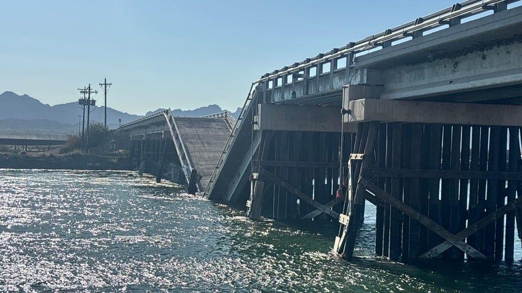
The fire's heaviest consequence was the loss of the Hart Mine Road bridge over the Colorado River, which collapsed on July 27 after fire damaged its structure, about a year after the nearby Oxbow Bridge burned. The two crossings had linked the Arizona and California banks for growers, hunters, anglers and birdwatchers, and farmers now face long detours to move produce and equipment to Yuma and California. Federal agencies set buoy barriers and signage around the debris in the river, and no injuries were reported. The Island Management Unit of the refuge and Hart Mine Road were closed, no structures beyond the bridge were damaged, and at least one alfalfa field burned. Incident data comes from the NIFC Wildland Fire Interagency Geospatial Services (WFIGS) feed.
Fire timeline
These headlines link to reporting by news outlets and agencies, not by AZMap.
Milestones synthesized by AZMap from the cited sources.
- Island Fire destroys key farming bridge near Cibola
ContainmentJuly 30, 2026
Containment reached 75% as managers ended scheduled morning updates.
- Island Fire collapses a bridge, burns through Cibola wildlife refuge in AZ
The fire destroyed one of only two bridges still linking the Arizona and California banks of the Colorado River in an area used by hunters, anglers and birdwatchers. Locals told the paper the fire started near Walter's Camp on the California side.
'Wall of fire': Farmer watches Arizona wildfire consume Colorado River bridge
Cibola farmer Amy Etienne described watching the fire reach her property and take out the Hart Mine Road bridge. Growers now face long detours to move produce and equipment to Yuma and California.
Read at Arizona's FamilyBridge over Colorado River collapses in western Arizona
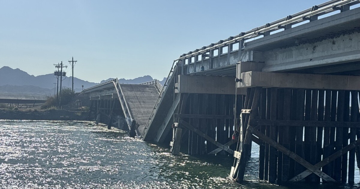
The Hart Mine Road Bridge collapsed into the Colorado River after the Island Fire damaged its structure. A Bureau of Reclamation spokesperson said crews installed barriers, signs and buoys and are looking at navigation lights so boaters do not hit the span in the water.
Read at KJZZSuspected fire damage linked to Hart Mine Road (Cibola) Bridge collapse; no injuries reported
Reclamation said the bridge over the Colorado River collapsed from structural damage tied to the fire, with portions of the span left in the water. Five federal agencies responded and installed buoy barriers and signage around the site.
Read at U.S. Bureau of ReclamationHart Mine Road Bridge collapses nearly one year after Oxbow Bridge burned

The collapse came about a year after the Oxbow Bridge roughly six miles away burned and closed, leaving farmers with a second lost crossing. La Paz County Supervisor Holly Irwin said the bridge is an essential equipment route for the farming community.
Read at KAWC Colorado River Public MediaBridge collapse forces detour along Colorado River in southwest Arizona
The collapse severed one of two major crossings between Arizona and California in the area, cutting a route farmers use to reach fields on the island. The Bureau of Land Management reported no structural damage beyond the bridge, and at least one alfalfa field burned.
Read at Arizona's FamilyIsland Fire Daily Update: 3,217 acres, 15% contained in Cibola refuge (July 28)
Crews built dozer lines and ran burnout operations on the fire in the Cibola National Wildlife Refuge, with 85 personnel assigned. The Island Management Unit and Hart Mine Road stayed closed after the road's bridge over the Colorado River collapsed.
Read at InciWebFirefighters battle Island Fire at Cibola National Wildlife Refuge

Engines, hand crews and aircraft worked the fire in La Paz County as more wildland firefighters were ordered in. Officials asked pedestrians, drivers and boaters to stay out of the area and reported no injuries.
Read at KYMAContainmentJuly 27, 2026
First containment reported: 15% at an estimated 3,218 acres.
Source: Arizona Daily Star · July 30, 2026, 7:20 AM
Island Fire collapses a bridge, burns through Cibola wildlife refuge in AZ. The fire destroyed one of only two bridges still linking the Arizona and California banks of the Colorado River in an area used by hunters, anglers and birdwatchers. Locals told the paper the fire started near Walter's Camp on the California side.
Read at Arizona Daily StarWildfire destroys bridge over Colorado River in southwestern Arizona
Parts of the Hart Mine Road bridge fell into the Colorado River after the fire damaged its structure, and no injuries were reported. Federal agencies set buoy barriers and signs to keep boaters away from the debris.
Read at Arizona's Family
Fire startJuly 25, 2026
Fire started on the California side of the Cibola National Wildlife Refuge and spread across the Colorado River into Arizona.
Source: KAWC Colorado River Public Media · July 28, 2026, 4:31 PM
Hart Mine Road Bridge collapses nearly one year after Oxbow Bridge burned. The collapse came about a year after the Oxbow Bridge roughly six miles away burned and closed, leaving farmers with a second lost crossing. La Paz County Supervisor Holly Irwin said the bridge is an essential equipment route for the farming community.
Read at KAWC Colorado River Public Media