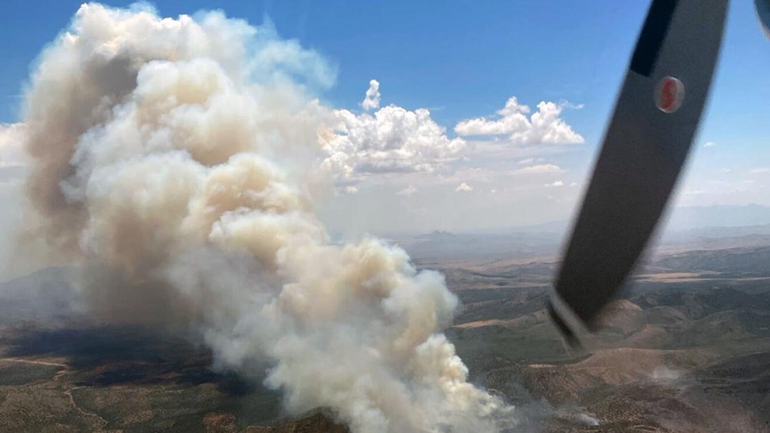
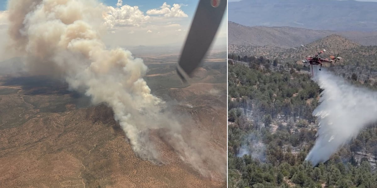
As of June 27, InciWeb put the Sycamore Fire at 11,859 acres and 37% contained, 15 miles north of Globe. Crews held perimeter lines under a Red Flag Warning through Sunday and prepared for possible spread west toward the Salt River. Griffin Ranch, Haystack Ranch, and M-K Ranch stay in SET status.
Gila County · 2026
Sycamore
Active · 11,852 acres · 37% contained
- Acres
- 11,852
- Containment
- 37%
- Last update
- —
Source: NIFC WFIGS feed
Current status
As of June 27, 2026, InciWeb put the Sycamore Fire at 11,859 acres and 37% contained, burning about 15 miles north of Globe in the Tonto National Forest. Crews held perimeter lines through the day and prepared for possible westward spread toward the Salt River, working a full-suppression strategy of direct extinguishment and indirect confinement.
A Red Flag Warning runs through Sunday evening, with afternoon humidity in the lower to mid teens and southwest wind gusts of 35 to 40 mph. Gila County kept Griffin Ranch, Haystack Ranch, and M-K Ranch in SET status.
Sources: InciWeb, Tonto National Forest
Recent updates
These headlines link to reporting by news outlets and agencies, not by AZMap.
- Sycamore Fire Daily Update: 11,859 acres, lines hold under Red Flag (June 27)
- Sycamore Smoke Outlook 06-26-2026
InciWeb posted the June 26 smoke outlook for the Sycamore Fire, a daily forecast of air-quality conditions in and around the fire for nearby communities while the incident stays active.
- Sycamore Daily Update 06-26-2026
As of June 26, the Sycamore Fire reached 11,852 acres at 37 percent containment about 15 miles north of Globe. A Red Flag Warning through Sunday brought afternoon humidity of 16 to 21 percent and wind gusts to 35 mph, and Griffin Ranch, Haystack Ranch, and M-K Ranch stayed in SET status.
- Sycamore Fire Daily Update: firing operations strengthen east-side lines (June 25)
InciWeb's June 25 daily update said crews ran firing operations Wednesday night to strengthen containment lines on the fire's east side, with containment strongest along Forest Service Road 645. Griffin Ranch, Haystack Ranch, and M-K Ranch stayed in SET status.
- Sycamore Fire Daily Update: 9,530 acres, 17% contained (June 24)
InciWeb's June 24 update put the Sycamore Fire at 9,530 acres and 17% contained north of Globe. Crews began strategic firing operations to strengthen lines on the southeast side, and Griffin Ranch, Haystack Ranch, and M-K Ranch remained in SET status.
- Gila County places M-K Ranch in SET status
On the evening of June 23, the Gila County Sheriff's Office placed the M-K Ranch area in SET status as increased activity on the Sycamore Fire raised the threat. Residents were advised to be ready to leave and to consider relocating voluntarily.
- Sycamore Fire Daily Update 06-23-2026
InciWeb's June 23 morning update reported the Sycamore Fire at 9,036 acres and 8 percent contained, with the fire most active on its northwest side and continued growth expected. Griffin Ranch and Haystack Ranch remained in SET status.
- Arizona wildfire burns more than 8,000 acres near Globe
The Sycamore Fire reached 8,083 acres and 7% containment as of June 22, burning in remote terrain west of U.S. 60 in the Tonto National Forest. Firefighters established the first containment line on June 20 along the southwest side; cliffs and canyons are hampering access for ground crews.
- Sycamore Fire north of Globe burns more than 8,000 acres with 7% containment
The Sycamore Fire held at 8,083 acres Monday morning with 7% containment, per the latest incident command report. The fire more than doubled from Saturday to Sunday, spreading northwest toward the Salt River Canyon Wilderness Area under hot, dry, and breezy conditions.
- Sycamore Fire doubles in size north of Globe
Arizona's Family reported the Sycamore Fire more than doubled from Saturday to Sunday, spreading northwest toward the Salt River Canyon Wilderness as hot, dry, breezy conditions drove rapid growth.
- Sycamore Fire burns over 8K acres in Tonto National Forest
The Sycamore Fire grew to 8,083 acres by Sunday evening with 7% containment, threatening nearby ranches east of Roosevelt Lake. Haystack Ranch and Griffin Ranch residents were placed in SET status, meaning they should be prepared to evacuate.
- Sycamore Fire Emergency Closure Order
The Tonto National Forest issued an emergency closure on June 17 barring public access to roads and trails in the Globe Ranger District because of the uncontrolled Sycamore Fire. The order runs through July 17 around forest roads 219, 220, 303, and 584.

Loading map…
About the Sycamore
Sycamore is an active wildfire in Gila County, Arizona. First reported June 15, 2026. As of the latest NIFC update the fire had burned 11,852 acres at 37% containment. Cause: Natural.
Live incident data comes from the NIFC Wildland Fire Interagency Geospatial Services (WFIGS) feed.