Gila County · 2026
Steamboat Fire
Historical · 1,576 acres · Final report · contained July 1, 2026
1 Miles S from DRIPPING SPRINGS, AZ
Incident data
About the Steamboat Fire
The Steamboat Fire was a 1,576-acre wildfire in desert grass and brush near the former mining camp of Troy, about 6 miles northeast of Kearny in Gila County, Arizona. It started June 26, 2026 and its cause was under investigation. NIFC recorded containment on July 1 and declared the fire out on July 7, 2026.
Gila County ordered GO evacuations for Linx Ranch and Victory Cross Ranch on June 26 when flames ran within three-quarters of a mile of ranch buildings, and placed Dripping Springs, Troy Ranch, and the Whispering Spirit community in SET status. All evacuation notices were lifted effective 6 p.m. on June 29 as containment climbed, and a Type 3 team began transferring command back to local fire officials. Incident data comes from the NIFC Wildland Fire Interagency Geospatial Services (WFIGS) feed.
Fire timeline
These headlines link to reporting by news outlets and agencies, not by AZMap.
Milestones synthesized by AZMap from the cited sources.
InciWeb operations maps · July 2, 2026
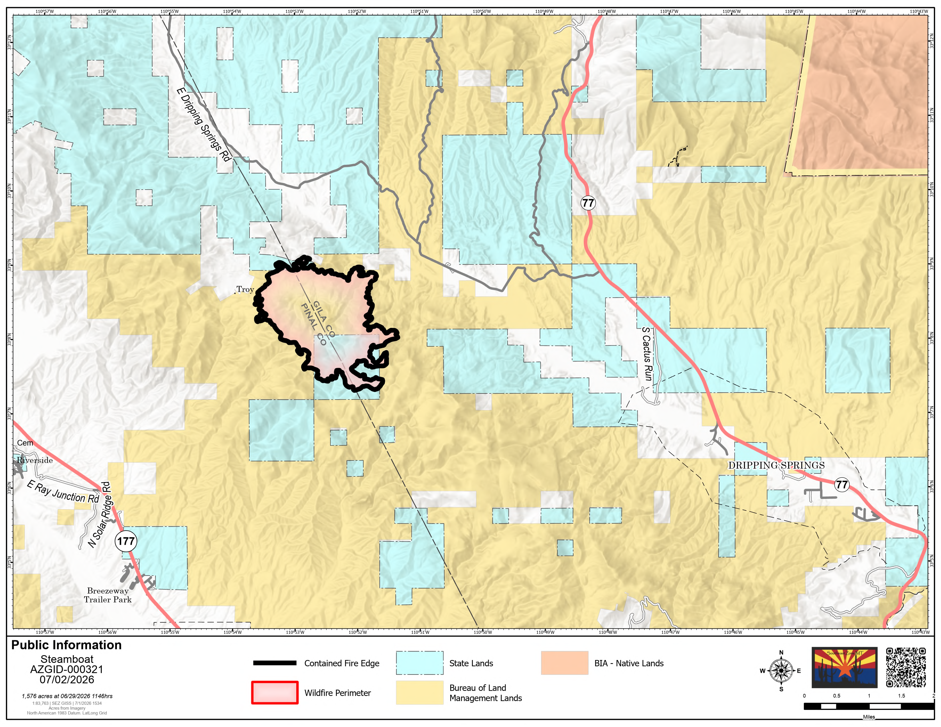
AZ-GID Steamboat Fire Perimeter Map - 07-02-2026 · Steamboat Fire Perimeter Map - July 2, 2026.
Operations maps from the incident team. The Public Information Map shows the fire perimeter with its contained and uncontained line, plus road closures; the Activity Map shows the day's firefighting activity around the fire.
ContainmentJune 30, 2026
Containment reaches 90% at 1,576 acres.
EvacuationJune 29, 2026
All evacuation notices lifted effective 6 p.m.
InciWeb operations maps · June 30, 2026
InciWeb operations maps · June 29, 2026
InciWeb photographs · 4 images · June 28, 2026
The fire's first days from the air, with active burning overnight on June 26.
Photograph 1 of 4.Steamboat Fire helicopter hovering over Kearny Lake as it reloads with water - June 28, 2026
Photos via InciWeb (NWCG). Public domain federal work except where a photographer or cooperating agency is credited.
InciWeb operations maps · June 28, 2026
EvacuationJune 26, 2026
Linx Ranch and Victory Cross Ranch residents ordered out as the fire grows.
Fire startJune 26, 2026
Fire starts northeast of Kearny in Gila County.
InciWeb photographs · 2 images · June 27, 2026
Photograph 1 of 2.Steamboat Fire discovered June 26, 2026 Photo provided by Arizona Department of Forestry and Fire Management
Photos via InciWeb (NWCG). Public domain federal work except where a photographer or cooperating agency is credited.