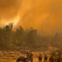
The fire grew from about 10 acres at discovery to 100 acres by August 24, 283 by August 26 and 485 by August 27 before passing 1,000 acres in a single day. Yavapai County Emergency Management reported no evacuation orders and no road closures.
- Acres
- 1,215
- Containment
- 82%
- Last update
- 22 hours ago
Source: NIFC WFIGS feed ↗
Loading map…
Current status
As of August 31, 2026 at 12:41 PM MST
As of the August 30, 2026 NIFC incident feed, the Campwood Fire stood at 1,215 acres and 82% contained, about five miles northeast of Bagdad in western Yavapai County. Assigned personnel are down to 9 under a Type 4 organization, with fire behavior reported as minimal, smoldering and backing in chaparral. The Arizona Department of Forestry and Fire Management holds jurisdiction, and cost to date stands at $660,000.
Lightning started the fire on August 23 on Blue Mountain, and it grew from about 10 acres at discovery to 485 acres by August 27 before passing 1,000 acres within a day. Helicopter crews used aerial ignitions to move fire off the mountain's steep terrain into areas where ground crews could work more safely, with the Navajo Hotshots among roughly 142 personnel assigned at the peak. Reporting on August 29 put the fire at 1,219 acres and 30% contained, and Yavapai County Emergency Management said no evacuation orders and no road closures were in place.
Sources: NIFC, AZ Forestry & Fire Management, News 4 Tucson, The Daily Courier, Arizona's Family
Fire timeline
These headlines link to reporting by news outlets and agencies, not by AZMap.
Milestones synthesized by AZMap from the cited sources.
- Campwood Fire reaches 1,219 acres near Bagdad, 30% contained
- Lightning-sparked Campwood Fire grows to 484 acres near Bagdad
About 142 personnel were assigned, including the Navajo Hotshots, as helicopters dropped aerial ignitions on Blue Mountain to push the fire downslope. Ground crews planned hand ignitions along Campwood Road to tie in with the aerial work.
- Campwood Fire grows to 1,219 acres as crews make progress near Bagdad
Helicopter crews used aerial ignitions to move the fire off Blue Mountain's steep terrain into areas where ground crews could work more safely. The running update put the fire at 1,219 acres and 30% contained, with mop-up focused along Campwood Road and the northern edge.

Fire startAugust 23
Lightning sparked a fire in rugged terrain five miles northeast of Bagdad.
Other active fires
No other active wildfires in Arizona right now.