Arizona could face cuts of up to 77% of its Colorado River allocation if states fail to reach a deal and the federal government imposes its own reallocation plan. Lake Mead stood at 1,048 feet in June 2026; Reclamation announced $52 million for new low-elevation Hoover Dam turbines.
Colorado River · U.S. Bureau of Reclamation
Lake Mead
Hoover Dam · 28.95 MAF capacity at full pool
Loading live data
Loading map…
About Mead
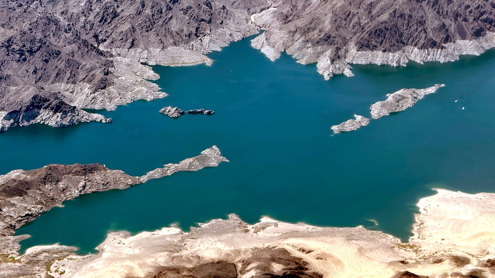
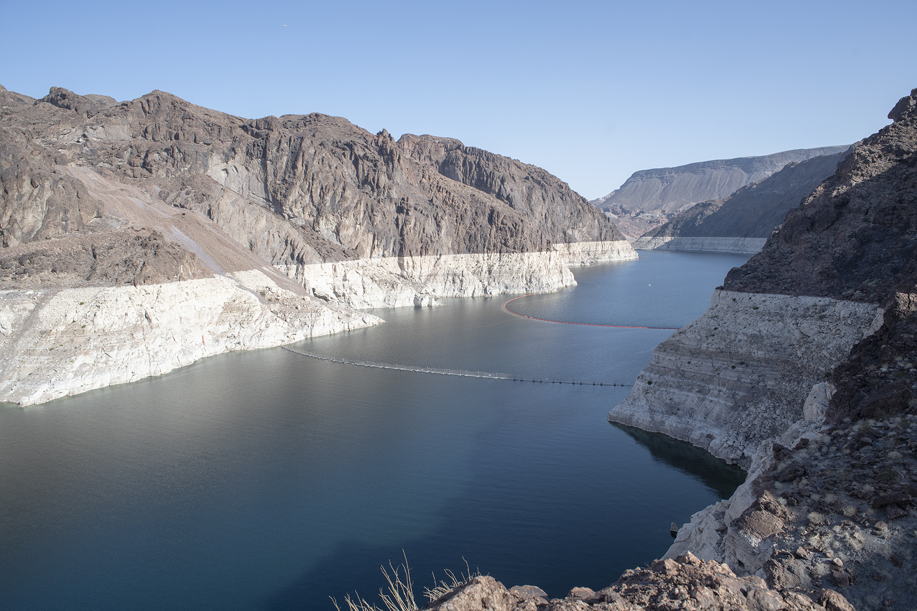
Lake Mead is the largest reservoir in the United States by maximum capacity. It sits behind Hoover Dam on the Colorado River, straddling the Arizona–Nevada border roughly 30 miles southeast of Las Vegas.
Hoover Dam was completed in 1936 and is operated by the U.S. Bureau of Reclamation. Mead supplies water to the Las Vegas metro, Arizona's Central Arizona Project, the Metropolitan Water District of Southern California, and Mexico under the 1944 U.S.–Mexico water treaty.
Daily storage, elevation, and release values come from the USBR Reclamation Information Sharing Environment (RISE). Shortage tiers follow the 2019 Lower Basin Drought Contingency Plan. USBR declares the operating tier for each calendar year in August, based on the projected January 1 elevation in the August 24-Month Study.
Recent coverage
Coverage from federal agencies and named news outlets. AZMap is not the publisher.
- Arizona faces 77% cut in share of Colorado River as states remain deadlocked over water allocation
- Lake Mead, Lake Powell Face 'System Crash' by 2028, Scientists Warn
A University of Colorado analysis warns that Lake Mead and Lake Powell face a "system crash" by 2028, with a roughly 2.6 million acre-foot annual shortfall between supply and use. Another dry year could force run-of-the-river operations, cutting off stored water deliveries and hydropower generation.
- Will Lake Mead – largest US reservoir – reach record lows?
The Bureau of Reclamation's May 2026 report projects Lake Mead could drop to 1,020 feet by July 2027, 20 feet below the 2022 record low of 1,040 feet. Upstream drought conditions in Utah and Colorado are rated extreme to exceptional as of mid-May 2026.
- Water supplies along Colorado River basin in peril, experts say
The Bureau of Reclamation's May 2026 24-month study projects Lake Mead could reach a record-low elevation of 1,036 feet in 2026, below the 2022 record of 1,040 feet. Inflow into Lake Powell between April and July is forecast at 800,000 acre-feet, the lowest on record at 13% of the period average.
- May 2026 Most Probable 24-Month Study
Reclamation's May 2026 24-Month Study projects Lake Mead water levels could reach 1,020 feet by July 2027, 20 feet below the 2022 record low. The Central Arizona Project diversion for 2026 is projected at 0.886 million acre-feet, down under Level 1 shortage restrictions.
- The Country's Largest Reservoir Is Running Low, Signaling A 'Dire Water Supply Situation'
Lake Mead's elevation stood at 1,058 feet in late April 2026, about 20 feet from its 2022 all-time low and 175 feet below maximum capacity. NOAA's drought coordinator attributed the decline to historically low snowpack that peaked 30 to 40 days earlier than normal across the Colorado River Basin.
- Lake Mead's lowest level on record could come in 2027, bureau says
Bureau of Reclamation projections released in March 2026 show Lake Mead could drop to 1,032.76 feet by November 2027, nearly 8 feet below the 2022 record low. States blew past a federal deadline to agree on post-2026 operating guidelines, leaving the government to impose a plan by October 1.
- 'Significant' Lake Mead Project to Begin This Month
The NPS launched a $2 million repaving of 3.7 miles of Willow Beach Road inside Lake Mead National Recreation Area, funded entirely from visitor entrance fees. Construction was set to run weekdays through mid-March 2026, with one-lane traffic delays expected during active work phases.